Day 8: POBR June 23, 2024
Day 8: June 23, 2024
The class was scheduled to wake up at 5:30am. The plan for the day was to go out to the field with a geologist. We got out in the field by 7am. Brennan Van Alderwerelt, a geoscientist was our field guide. Van Alderwerelt works with the Washington Department of Natural Resources but is very familiar with the landscape and history of this area we were stationed at. First and foremost, Van Alderwerelt started off with a land acknowledgment. He stated that the first people of this land were the Northern Paiute (Numu), Western Shoshone (Sosone), Cayuse, Sahaptin (Tenino, Celilo, Tukspust, and other Warm Springs bands), Snake, Wasco and Wishram (Chinook), Bannock, WallaWalla, Nez Perce, Wanapum, and even Molala. Van Alderwerelt stated that the historic evidence holds a strong indigenous perspective in western science. Van Alderwerelt also shared that human habitations (rock shelters and pit houses) in the John Day area have been dated as over 5,000 years old, although the evidence is not clear who built these settlements.
The first site visit (at a small ridge), in the John Day area/Wheeler County outside of Mitchell, Oregon.Van Alderwerelt started the conversation with this question, “how do rocks form?” Van Alderwerelt shared that there are three different materials of rock. One, igneous rocks which is formed and cooled by liquids (an example would be the Columbia basalt). Two, sedimentary rocks which are rocks made of particles (sand, dirt, and/or sediment). And three, metamorphic rocks can change shapes. Brennen took us to a few sites just a few miles from our camp. This site we stopped off at Van Alderwerelt described it as a continental shelf. Majority of the rocks present were basalt and quartz. Our mission was to hammer in a few places near the rocks and then identify what materials was present. Some rocks and sediment found was dated from dinosaur ages—which I found interesting.

Figure 1: Viewpoint from site two.
The second site was a few miles up the road, where there was a steep hill of gravel (ridge area). We all walked over there and observed the area and asked ourselves how this hill is formed this way. Van Alderwerelt explained that a lot of these steep gravel hill sides (pictured in figure 2) are mostly caused by humans (mining). Also present was a mound of volcanic ash from mazama from 77 hundred years ago (pictured in figure 3). Van Alderwerelt also shared a story from the Klamath tribe.

Figure 2: Observation of landscape.
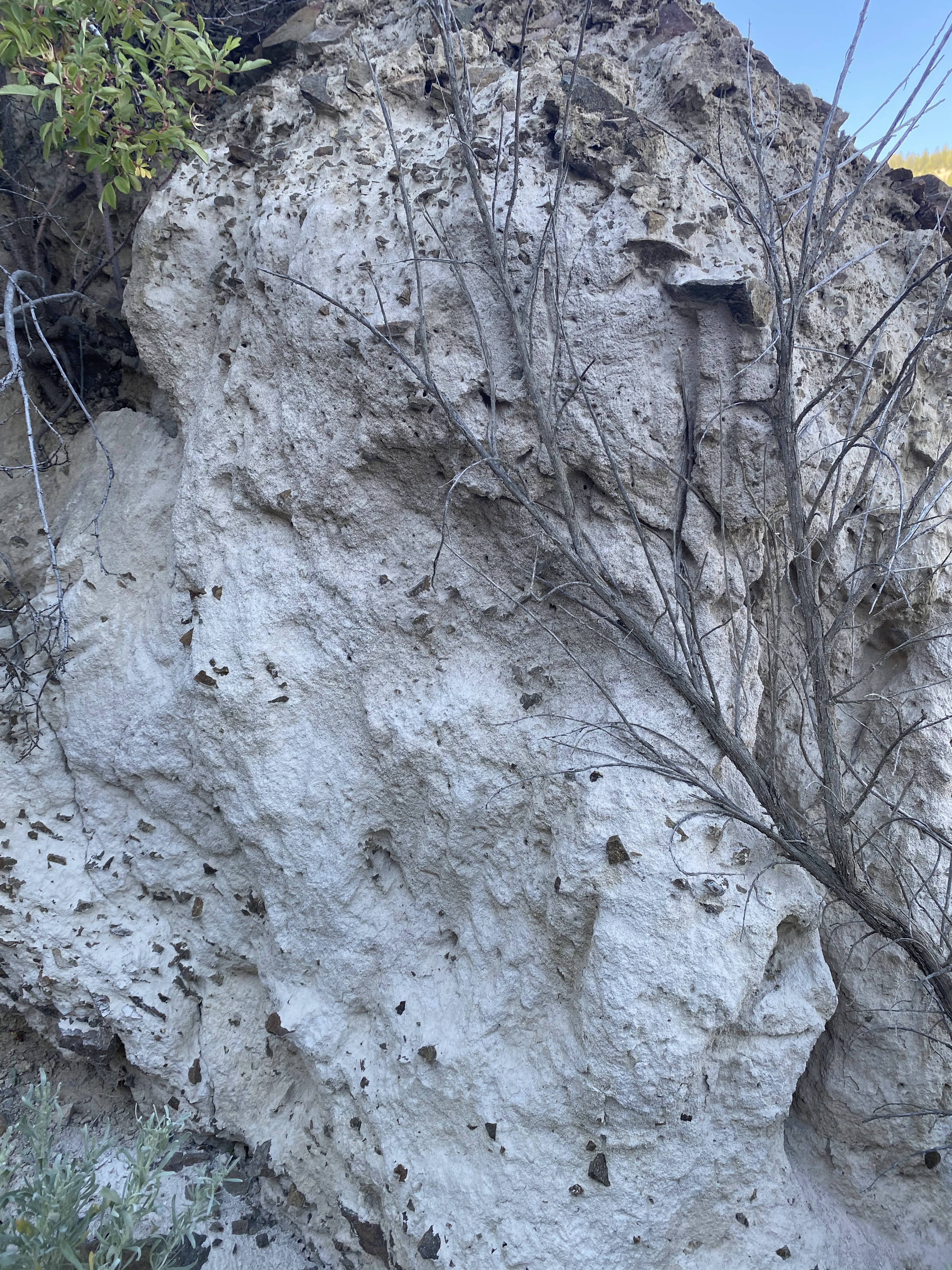
Figure 3: Volcanic ash from the eruption of Mazama.
The third site, we hiked up a ridge to observe the differences of the landscape. Observations that were made was the difference in the soils, plants and rocks. From the top of this ridge, we were able to see the views of the Columbia River Basalt which was dated 16 million years ago. Along the roadside, we also found a historic area that had protentional fossils. We were all digging in the dirt looking for any potential fossils. Even though we can’t confirm anything without a paleontologist, it was fun looking at potential historic evidence.
The fourth site visit was the Painted Hills(pictured in figure 4), which is protected area. This site was so beautiful because it contains a lot of historic evidence in the area. We learned that the ironred paleosols indicate a warm and moist environment where the soil was usually damp. To emphasize the meaning of Paleosols, would be describing the old soil/fossilized dirt that was formed by landscape of the past. To be more specific, the paleoenvironment of the red hill layers was an enormous change from the semitropical jungle of deeper and older rock layers. The yellow and tan soils indicate a drier environment than the red layers. And the black spots are caused by manganese concentrations. These are the indications that some sort of plant that fixed manganese in the soil. This site is considered a rare geological exposure.

Figure 4: Painted hills.
Van Alderwerelt predicted that painted hills was dated from 20-25 million years ago. Van Alderwerelt emphasized that the past influences the present. He also explained that the efflorescence is clays in the soils and that explains why there is not a lot of plant growth. To conclude the site visits, we stopped off at the visitation center in the valley bottom of the painted hills. Van Alderwerelt shared a lot of historical stories and features of the area. Van Alderwerelt concluded his tour with this question, “Why should we consider geology?” Van Alderwerelt shared that geology is specific to an area based on communities. It’s the knowledge of land, people, history, and culture. Van Alderwerelt also shared that geologist can also have positive impact within the communities. Van Alderwerelt is very passionate about his work. A lot of stories, history, and evidence that was shared during this site visit is very eye opening. During our travel to our next destination, we were all enjoying the views and trying to apply some of the stories and knowledge to the scenery.


Comments
Post a Comment